
PROJECT TEAMS · 3D DOCUMENTATION
Give your entire team a clear view of the site, even remotely.
Mat4LuX provides 3D scanning of buildings in Luxembourg to create an immersive representation accessible remotely, helping architects, engineering consultancies, project owners and technical teams understand, prepare and share a project.
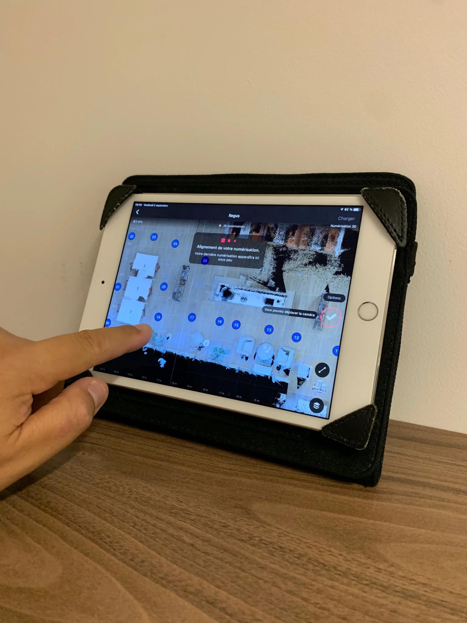
ONE SHARED VIEW OF THE SITE
Building, retail space, offices, technical room or space to be transformed.
A SHARED VISUAL REFERENCE
Work from the same site reference, even when the whole team is not on site.
A 3D scan creates an accessible representation of the building that can be shared with everyone involved in the project. Team members can return to the spaces remotely to prepare a meeting, check a detail or better understand the existing environment.
Reduce Unnecessary Site Visits
Review the site remotely whenever a physical presence is not essential to move a question forward.
Prepare Decisions More Effectively
Revisit the spaces before a meeting, intervention or design phase to have the context you need.
Share the Same Understanding of the Site
Everyone involved works from the same visual reference rather than isolated photos or memories from a site visit.
The site becomes a project resource: it can be reviewed remotely during design, preparation, construction or maintenance phases.
WHO IS IT FOR?
A site representation that supports everyone involved in the project.
Architects, technical teams, project owners and contractors can access the same 3D environment to better understand existing conditions and prepare their work.
Architects
Revisit the building remotely to understand volumes, prepare a transformation and communicate more easily with the client or other stakeholders.
Engineering Consultancies
Use additional visual context to prepare a technical study and better locate equipment, access points or visible site constraints.
Maîtres d’ouvrage & AMO
Share a common representation of the building with stakeholders and make discussions easier during decision-making phases.
Facility & maintenance
Keep visual documentation of the spaces to prepare an intervention, identify an area or guide a service provider remotely.
Contractors
Prepare work more efficiently by reviewing access points, volumes and the general environment before returning to the site.
Propriétaires & exploitants
Create an accessible representation of your property assets to simplify communication with teams, service providers and external partners.
A PRACTICAL 3D SITE REPRESENTATION
More than a series of photos: a site your team can navigate and review remotely.
Matterport scanning recreates the spaces in a navigable environment, allowing teams to recover the context of a building, understand its layout and revisit specific points without having to return to the site every time.
Navigate the Building
Move virtually through the different rooms and review the overall site environment from a computer, tablet or smartphone.
Understand the Volumes
The overall 3D view helps you understand the building layout, the relationship between spaces and the general circulation between areas.
Take Indicative Measurements
Built-in tools can help check certain dimensions directly in the tour when preparing a discussion or an initial site assessment.
For work requiring contractual accuracy, a dedicated technical survey is still required.Recover the Visual Context
Check the visible location of equipment, an opening, an access point or a building element without searching through a series of separate photos.
DELIVERABLES
One Site Scan, Multiple Resources to Work and Share.
Depending on the project, the Matterport scan can be accompanied by different deliverables to support review, documentation and communication between stakeholders.
Matterport 3D Virtual Tour
A navigable representation of the site that allows stakeholders to revisit the spaces from a computer, tablet or smartphone.
Shareable Access Link
The tour can be shared with the relevant people so they can access the same environment without installing dedicated software.
Schematic Floor Plans
Depending on the project, Matterport schematic floor plans can complement the 3D tour with a simplified view of each level. Availability is confirmed at the quotation stage.
Site Views and Images
Views from the scan can be used to document a point, illustrate a meeting or facilitate communication between teams.
Building documentation, work preparation, maintenance or remote collaboration: we define from the outset the deliverables that are genuinely useful to your team.
Real example of a Matterport scan of a construction site.
SEE IT BEFORE EXPLAINING IT
Explore a Real Construction Site from Your Screen.
This 3D tour shows how a Matterport scan can give stakeholders a shared representation of the site, accessible remotely to revisit spaces, prepare a discussion or better understand existing conditions.
Move between the different areas as if you were on site.
Review the volumes, access points and overall site layout.
Give all stakeholders access to the same representation of the construction site.
REMOTE COLLABORATION
Bring Your Teams Together Around the Same Environment, Even When They Are Not On Site.
The 3D tour can serve as a shared reference during a meeting, work preparation or a discussion with a service provider. Participants have the same visual context when discussing a space, access point or area of the building.
Share Access to the Site
Stakeholders can access the same 3D tour through a shared link, with no dedicated software installation.
Return to a Specific Area
A room, visible piece of equipment or access point can be reviewed during the discussion to immediately put the conversation back into context.
Make Discussions Easier
The team can rely on the same representation of the building rather than descriptions, memories from site visits or scattered photos.
Prepare the Next Action
Use the tour to prepare a meeting, technical intervention, physical site visit or the next project phase.
The project owner, architect and contractor can open the same 3D tour during their meeting and review the relevant area together.
USE CASES
One Scan Can Support Multiple Stages in a Building’s Lifecycle.
The 3D tour can be used to prepare a transformation, document existing conditions, organise an intervention or facilitate communication between project stakeholders.
Renovation Project
Keep a representation of the existing condition to help teams understand the spaces before working on their transformation.
Work Preparation
Allow contractors and stakeholders to review access points, volumes and the environment before another site visit or on-site intervention.
Maintenance & facility management
Use the tour as a visual reference to locate an area, prepare a service provider or provide context for an intervention request.
Existing Site Documentation
Keep a visual record of the site at a given point in time to support communication and later review the organisation of the spaces.
Multi-site Management
For a property portfolio or multiple locations, 3D tours can make it easier for central teams, technical teams and external service providers to review different buildings remotely.
FREQUENTLY ASKED QUESTIONS
What to Know Before Scanning a Site for Your Project Teams.
Access, measurements, sharing, deliverables and building changes: here are the main questions about using a 3D tour in a professional context.
01 What Types of Buildings Can Be Scanned?
Offices, retail spaces, industrial buildings, technical rooms, public-facing facilities and other existing spaces can be scanned provided site access allows the capture to be carried out.
02 Can Several People Access the Same 3D Tour?
Yes. The tour can be shared with the relevant stakeholders so they all have access to the same visual representation of the site and can review it remotely.
03 Is Software Required to View the Tour?
No. The Matterport tour can be viewed in a compatible web browser on a computer, tablet or smartphone, without each user having to install dedicated software.
04 Can Measurements from the Tour Be Used for Construction Work?
The measurement tools can be useful for an initial check or to prepare a discussion. However, they do not replace a dedicated technical survey when contractual dimensions or specific accuracy are required.
05 Can Floor Plans Be Provided Alongside the 3D Tour?
Depending on the project, Matterport schematic floor plans can be provided alongside the 3D tour to give a simpler overview of the space layout.
06 What Happens If the Building Changes After the Scan?
If the building is renovated, reconfigured or significantly modified, a new scan can be carried out to provide a representation of the updated site.
07 Can This Solution Be Used Across Multiple Buildings?
Yes. For organisations with multiple locations, scans can be organised site by site to create visual documentation accessible to central teams or relevant service providers.
08 Can We Receive a Standalone Deliverable to Host on Our Own Infrastructure?
For certain projects, Mat4luX can assess the delivery of a standalone static export designed to be hosted on the client’s own infrastructure. The terms are defined according to the requirements, expected deliverables and project scope.
LET’S DISCUSS YOUR PROJECT
Your Site, Your Teams, Your Constraints: Let’s Define the Right Setup.
Tell us how your teams work and what you need to document. We will propose a configuration suited to the site, its users and the deliverables you actually need.
We identify the use case, stakeholders and site constraints before defining the service.
3D tour, sharing, schematic floor plans or documentation: only the elements useful to your project are included.
The service can be organised for one building or multiple locations.
Tell Us About Your Requirements
A few details are enough for us to carry out an initial assessment of your project.